Our projects
Saga
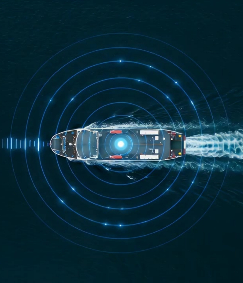
No Vessel Unseen.
Traditional systems – coastal radar, AIS, drones, and patrol aircraft – leave blind spots, especially far from shore, in the High North, and in adverse weather. Dark and deceptive vessels can switch off AIS, spoof identity or position, and operate beyond conventional monitoring.
Saga No Vessel Unseen is built to address this challenge. Using advanced C-band Synthetic Aperture Radar (SAR) with wide-swath coverage and high-resolution imaging optimised for the maritime domain, it will provide persistent, all-weather, day-and-night surveillance over large ocean areas. A constellation-level Track-While-Scan (TWS) concept, integrated AIS reception, and automated processing will deliver correlated, validated detections and actionable intelligence – a non-cooperative “truth layer” showing what is actually on the water, not just what is reported.
Developed to meet Norwegian and allied defence requirements, Saga is engineered for seamless integration into modern command, intelligence, and MDA systems, combining theatre-scale coverage with tactical-level detail and enabling sovereign, trusted maritime surveillance for Norway and its allies.
-
Ready to explore how Saga - No Vessel Unseen can strengthen your maritime security and surveillance capabilities?
Contact our expert team to discuss tailored solutions, partnership opportunities, or Saga’s system specifications.
The Saga Advantage
No Vessel Unseen.
Saga’s capabilities will represent a step change in Maritime Domain Awareness for Norway and its allies; a next-generation spaceborne radar system delivering sovereign Intelligence, Surveillance, and Reconnaissance (ISR) across vast ocean areas, and providing trusted insight to strengthen security, defence, and environmental protection at sea.
Closing the gaps at sea
A non-cooperative “truth layer”
Conventional coastal radar, AIS networks and limited patrol assets leave critical blind spots offshore and in the High North. Vessels can switch off AIS, spoof their identity or position, or operate beyond the reach of shore based sensors. The HRWS-constellation is designed to close these gaps and give decision makers greater confidence in every maritime decision.
By adding a non-cooperative “truth layer” over the maritime picture, Saga – No Vessel Unseen, will deliver persistent coverage of vast Areas of Interest, independent of light and weather.
Since radar returns cannot be spoofed simply by turning off a transponder, they provide a trusted way to verify what is at sea and to expose dark or deceptive behaviour.
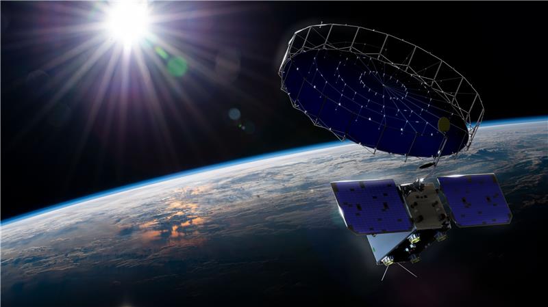
Technology and capability
High-resolution, wide swath C-band SAR
At the core of Saga is a high resolution, wide swath C-band Synthetic Aperture Radar optimised for open ocean surveillance.
Each satellite can scan hundreds of thousands of square kilometres in a single pass while still focusing on individual vessels as well as small craft with enough detail to support classification and threat assessment.
This blend of wide swath and fine resolution, together with all‑weather, day‑and‑night performance at all latitudes, gives operators reliable situational awareness. It continues to work when optical sensors, crewed aircraft, and drones are constrained by cloud, darkness, or polar conditions.
Track-While-Scan from orbit
The architecture introduces a constellation level Track-While-Scan concept. Rather than acting as isolated satellites, HRWS C‑band SAR units are designed to function as a coordinated orbital radar layer. This shifts the system from static snapshots to real‑time vessel tracking across designated Areas of Interest.
Automated intelligence outputs include precise vessel position, indicators of hull size, course, speed and track history.
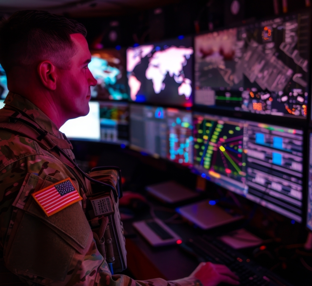
Instead of delivering only images, this solution provides structured, machine readable intelligence products that integrate directly into existing operational workflows and C4ISR systems.
Integrated with AIS and C4ISR
AIS correlation and validation
The system fuses non‑cooperative SAR detections with cooperative AIS broadcasts to create a more complete maritime picture.
Onboard AIS receivers correlate vessel signals with radar returns, and automated cross checking exposes dark vessels operating without AIS, spoofed positions and identities, and ghost tracks or other manipulation.
Hence, this fusion creates a more reliable and evidential maritime picture, suitable for operational use as well as legal and compliance cases such as sanctions enforcement, embargo monitoring and countering shadow fleets.
C4ISR ready outputs
From day one, Saga is designed to integrate with modern defence, security and government systems.
Standardised, secure interfaces provide C4ISR ready outputs and data products tailored for maritime operations centres, joint and combined headquarters, as well as national MDA and intelligence systems. Users will therefore spend less time transforming data and more time acting on it.
Operational effects and value
Persistent reach where it matters most
Deploying additional satellites will increase revisit rates over priority regions. These include Arctic and North Atlantic sea lanes, as well as other high‑value maritime zones such as the Norwegian and Barents Seas, Baltic Sea approaches, the Sea of Japan, the East China Sea, and the northern and western maritime regions of Australia.
The constellation will also focus on critical maritime chokepoints and straits, as well as areas around seabed infrastructure, LNG terminals and key ports.
This persistent reach enables early detection of anomalous or potentially hostile activity, continuous surveillance of patterns of life in sensitive maritime domains, and assured ISR coverage in regions where ground or airborne assets are scarce or constrained by weather.
Force multiplier for maritime assets
No Vessel Unseen capability is not intended to replace ships patrol aircraft or other space assets; it is designed to make them far more effective. By directing space, air and naval assets to real points of interest, it reduces time and cost spent searching and increases time spent interdicting, inspecting and deterring.
As a strategic surveillance layer, it delivers coverage at significantly lower cost and risk than attempting to achieve comparable reach with airborne platforms alone.
Core use areas
Security and defence missions
No Vessel Unseen is purpose‑designed to support a broad spectrum of security and defence missions. It helps detect dark vessels and AIS spoofing, supports sanctions and embargo enforcement against shadow fleets, and monitors grey zone activity, covert logistics and suspicious patterns of life.
By improving the quality and timeliness of the maritime picture, the platform enhances fleet effectiveness and supports stronger maritime domain control, including in contested waters.
Civil and environmental applications
With its dual use profile, Saga also addresses wider governmental as well as environmental needs. It can extend fisheries surveillance far beyond the range of coastal radar, support search and rescue operations by rapidly building scene awareness in harsh environments, and assist in oil spill and pollution monitoring through early detection and wide area follow up.
This combination of defence, civil and environmental value makes it a compelling investment for Norway and allied nations.
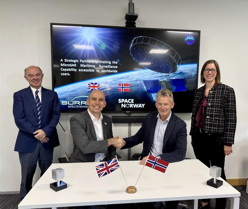
Space Norway, a 100% state‑owned satellite operator with decades of experience in critical space infrastructure, has developed Saga – No Vessel Unseen. The system provides a reliable, allied‑controlled capability and a trusted basis for cooperation and data sharing in sensitive and classified missions.
This committed programme will deliver advanced maritime ISR and MDA capabilities for Norway and its allies. It is set to become a central pillar of future maritime surveillance architectures. It builds on strong industrial partnerships and a defined deployment path.
Surrey Satellite Technology Limited (SSTL) is building a technology demonstration satellite with payloads from WideNorth, EIDEL, Norwegian Defence Research Establishment (FFI), Kongsberg Discovery and Kongsberg Seatex.
Saga’s construction started in 2022, with launch on a SpaceX mission scheduled for 2027. The system is developed as a multi‑satellite constellation to provide high‑revisit coverage of key maritime areas and a scalable foundation for future capability growth.
Saga is a C-band SAR Earth observation satellite named after the Norse goddess Sága, whose name is linked to seeing and storytelling. True to its name, Saga will watch over the world’s oceans from orbit, transforming complex maritime activity into timely, actionable insight. From its vantage point in space, Saga will continuously monitor activity at sea, converting streams of sensor data into a coherent operational picture that helps protect oceans and critical maritime infrastructure – leaving No Vessel Unseen.
Discover more
-
Government
-
Maritime services
MaritimeAn ocean of possibilities for any fleet.
-

Partnerships