Back to all News

Arctic broadband operational

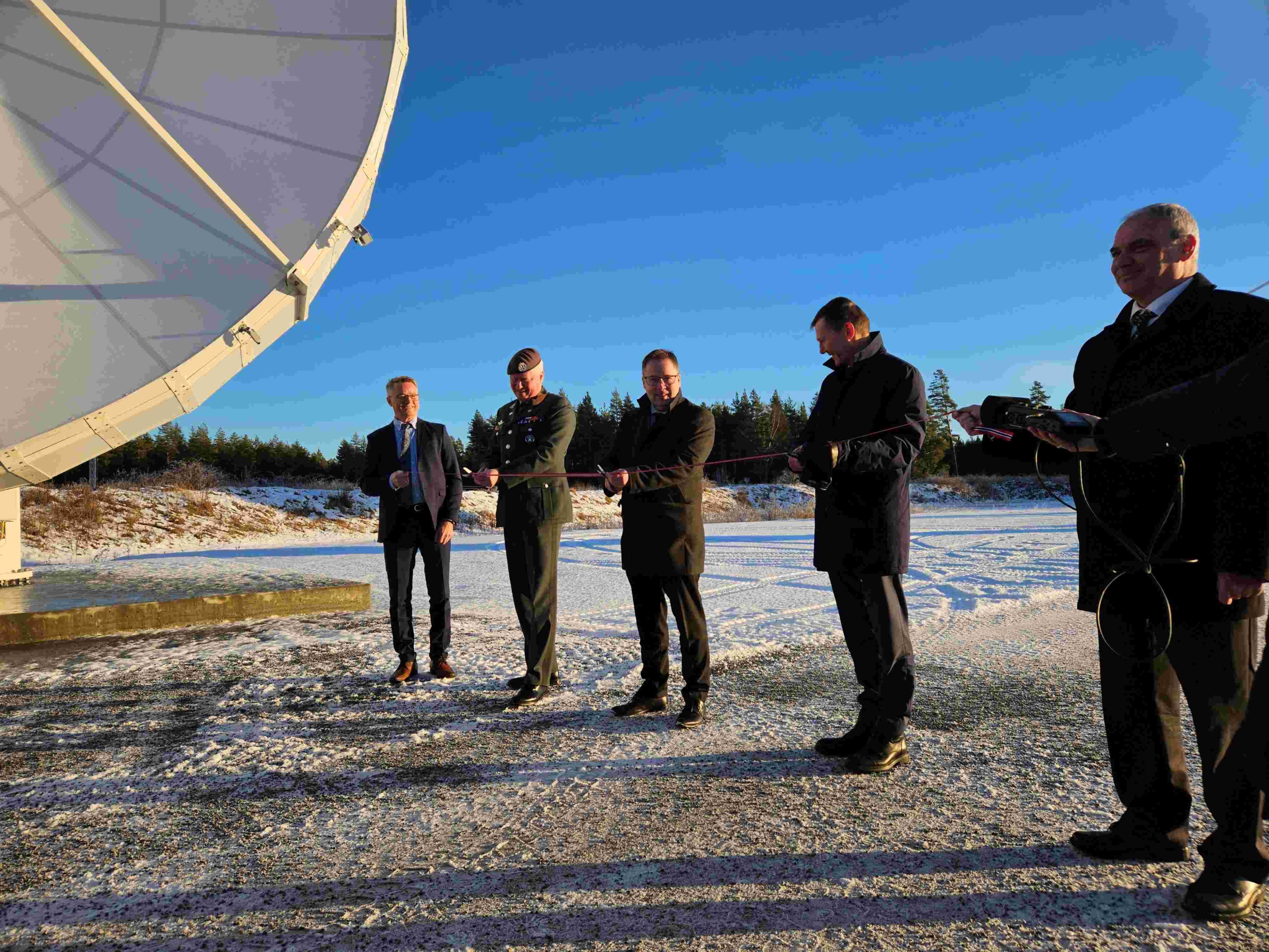
Norway’s largest satellite program is now operational. Today, Defense Minister Bjørn Arild Gram marks the capacity being utilized by the Armed Forces through a satellite call to a coast guard ship.

This summer, Space Norway launched two large satellites into highly elliptical orbit. Since then, the satellites, payloads, and ground stations have undergone extensive testing by the owner, customers, and supplier.

“We are both proud and pleased to deliver perfectly functioning payloads with antennas and associated ground systems to the Norwegian Armed Forces. Delivering this capacity to the Norwegian Armed Forces is the primary rationale for the ASBM program, which is Norway’s largest space program to date. No other country has a solution like the one the Armed Forces now have,” says Kjell-Ove Skare, Program Director at Space Norway.

Strategically important

With this delivery, the Armed Forces secure broadband coverage throughout the Arctic, thereby gaining control over strategically important communication services in vast areas that have previously been without coverage. The northern regions have been described by several governments as Norway’s most important foreign policy interest area, and communication services are crucial for both domestic use and cooperation with allied forces in the north.

“Broadband in the Arctic will have a significant impact on the Armed Forces and our communication capabilities in the northern regions. It allows us to exercise effective command and control in all types of operations up to the North Pole. The ASBM program also opens up multiple opportunities for collaboration across defense branches and with our allies. This is an important milestone for Norway’s defense capability. We are grateful for the excellent cooperation with other stakeholders, resulting in the strengthening of the Armed Forces’ operational capabilities in the northern regions and the Arctic,” says the Chief of the Cyber Defense, Brigadier Halvor Johansen.

Brigadier Halvor Johansen
Chief of the Cyber Defense

“Broadband in the Arctic will have a significant impact on the Armed Forces and our communication capabilities in the northern regions”

Unique collaboration

In addition to being Norway’s largest satellite project, this program is unique in several ways. The size of the project made it impossible for a single actor to manage alone. This satellite program is groundbreaking through its unique collaboration between allied, governmental, and commercial interests. It demonstrates the potential of international cooperation that is both cost-effective and meets commercial and public needs simultaneously.

Throughout the project, Space Norway has focused on the users, whether military or civilian, on the ground, in the air, or at sea. Read more about the project here and here. The construction of the communication satellites has been ongoing for five years, and they contain payloads for the satellite operator Viasat, the Norwegian and American Armed Forces, and the EU Commission. As planned, Space Norway has delivered payloads and capacity to the project customers during the fall. Viasat expects to launch its services at the beginning of the new year.

Back to all News

Important delivery from ASBM

Delivering valuable radiation data to the European Commission

How to efficiently protect satellites from damaging space radiation? Knowing when, where and how much is critical. As of Friday November 29th, Space Norway delivers important space radiation data to the European Commission.

On board Space Norway’s Arctic Satellite Broadband Mission (ASBM) is NORM – a space radiation monitor developed by IDEAS with the support of the European Space Agency and the Norwegian Space Agency.

“Data from this satellite will benefit various EU space programs such as Gallileo, Egnos, SST and Iris2. This partnership has flourished, demonstrating the close cooperation between Norway and the European union in the realm of space. This mission is really a statement to the power of international space cooperation”, says Christoph Kautz, Director for Satellite Navigation and Earth Observation, European Commission.

Since its launch on board ASBM-2 on August 11th, 2024, NORM has been successfully collecting radiation data, including during the important initial phase of orbit-raising. Now, in its nominal orbit, it measures radiation levels all along ASBMs highly elliptical polar orbit and sends it to down to earth.

Gives early warning

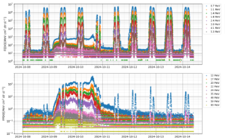
NORM has already been able to return valuable insight on the proton flux in orbit, notably during the recent solar storm on October 9th. The instrument observed a very large, rapid spike in proton differential flux over the course of a few days. Data such as this could be useful in providing early warning and assessing risks of ongoing solar activity. Preliminary in-orbit data from the electron channels illustrate the instrument’s ability to precisely characterise the outer radiation belt.

This image has an empty alt attribute; its file name is Bilde1.png

The satellite travels through both the inner and outer Van Allen Belts, enabling cross-calibration with other missions and providing observations of the highly variable particle intensities in these regions.

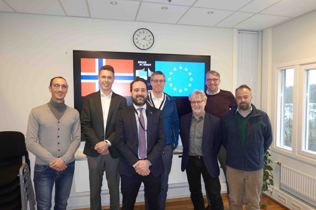
Representatives from the European Commission, Space Norway, IDEAS and The Norwegian Space Agency gathered in Oslo of Friday for a final review and to celebrate the conclusion of a successful project phase and start of operations.

“I really appreciate the relationships and trust we have been able to build between all parties in the project phase. I am also very happy to see that the service and data that we deliver to the EC is of good quality and in line with what we have worked towards over the last few years. We look forward to the continued cooperation and to deliver valuable data to the EC for many years to come,” says Matias Krogh Boge, SPN Project Director ASBM Radiation Data Service Project.


More information:

The Van Allen radiation belt consists of trapped particles from two belts of radiation that surround the Earth like enormous donuts. It is a zone of energetic charged particles, most of which originate from the solar wind, that are captured by and held around a planet by Earth’s magnetosphere. The magnetosphere traps the high energy radiation particles and shields the Earth from the solar storms and the constantly streaming solar wind that can damage technology as well as people living on Earth. The outer belt is made up of billions of high-energy particles that originate from the Sun and the inner belt results from interactions of cosmic rays with Earth’s atmosphere. The belts endanger satellites, which must have their sensitive components protected with adequate shielding if they spend significant time near that zone.

The European Union develops and operates space infrastructures such as Galileo, EGNOS, Copernicus, Space Surveillance and Tracking and later IRIS2. The NORM data will be useful for design, operations, and diagnosis for these EU missions, and beyond.

In addition, access to the data will be facilitated for the scientific community to contribute to the broader understanding of Sun-Earth interaction and of the effects of space weather on Earth’s magnetosphere, and other space-based technologies, including the derivation of nowcasting/forecasting products and warnings.

In addition, access to the data will be facilitated for the scientific community to contribute to the broader understanding of Sun-Earth interaction and of the effects of space weather on Earth’s magnetosphere, and other space-based technologies, including the derivation of nowcasting/forecasting products and warnings.

NORM‘s particle telescope is a stack of 9 silicon detector diodes and 5 absorbers, designed as an easily adaptable unit for satellite missions in GEO, LEO, and HEO.

The ASBM satellites, composed of 2 satellites placed in highly elliptical TAP orbits with an orbital period of 16 hours and crossing altitudes between 8,700 and 43,000 km provide broadband telecommunication over the Arctic.

Back to all News

Space Norway's Arctic Broadband Satellite Mission nominated for SpaceNews' ICON Award.

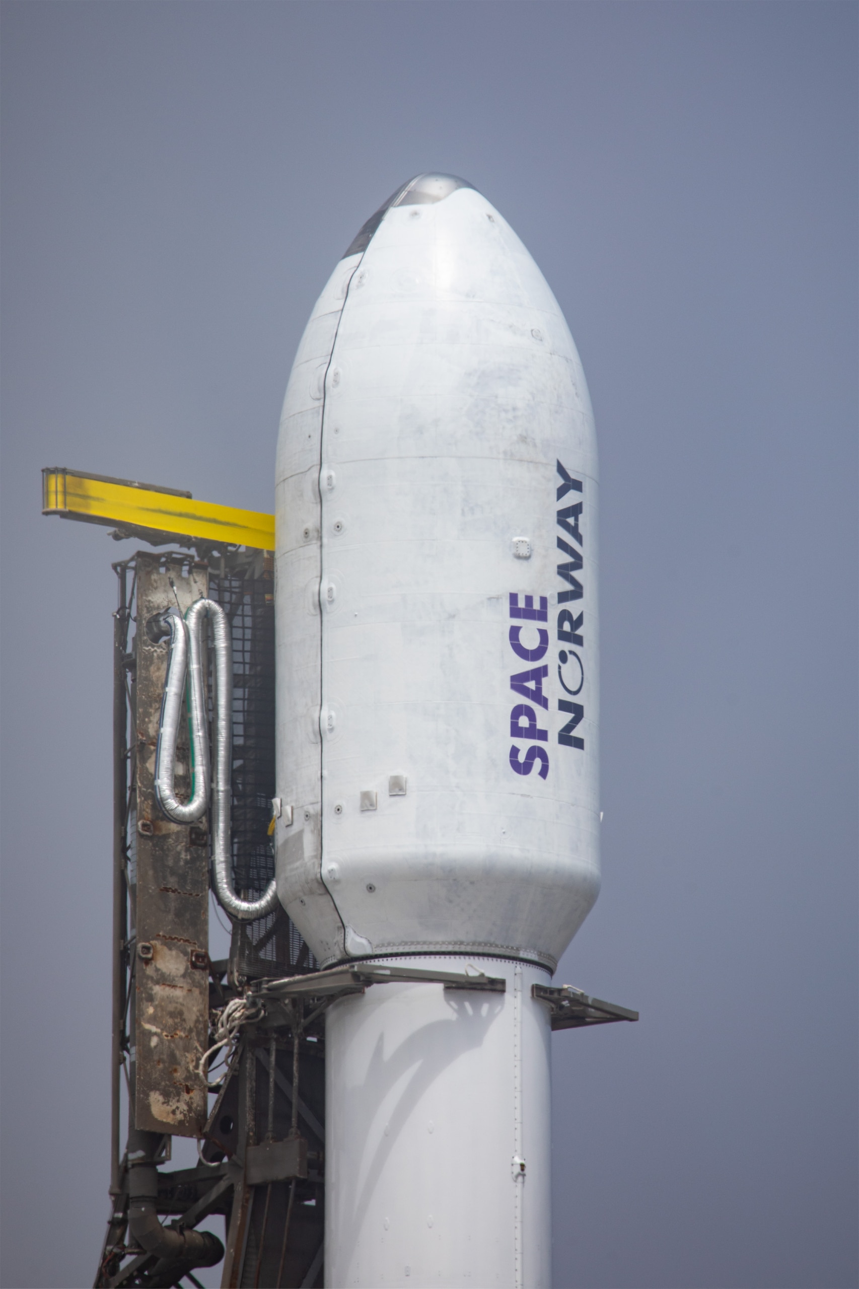
SpaceX's Falcon9 rocket with the two ASBM satellites on board.

According to SpaceNews, the Icon Awards celebrate the year’s most iconic achievements shaping the direction of the space industry. A selection of individuals, organisations and missions that exemplify excellence in advancing space exploration, sustainability and innovation are shortlisted for the prestigious award. This year, Space Norway’s Arctic Broadband Satellite Mission is of one of the shortlisted.

Advancing space exploration

A selection of individuals, organisations and missions that exemplify excellence in advancing space exploration, sustainability and innovation are shortlisted for the prestigious award, including Space Norway’s Arctic Broadband Satellite Mission.

“Space Norway is proud to have been nominated in the category “International Collaboration” together with Artemis Accords and Intelsat”, says programme director Kjell-Ove Skare.


Proud of the programme

Skare emphasises that all in Space Norway are extremely proud of this programme. “It is truly an honour to be shortlisted for this award. This is a ground- breaking effort in an allied, governmental and commercial collaboration”.

The ASBM programme is a showcase of how governmental and commercial needs can be met at a critical point for all involved.

“Our focus in this mission is the value it creates for civil users such as ships, aircraft and governmental users such as rescue services and the coastguard, as well as national and allied forces. It would not have been possible without the excellent cooperation we have had with our partners at Viasat, the US Space Force and Northrop Grumman. I believe this mission sets a standard for future international collaboration in space, and Space Norway is eager to expand on the work we have started with ASBM,” comments Skare.

This image has an empty alt attribute; its file name is Partners.jpg